Welcome to the

mapping

revolution

A unique place of geospatial innovation where anyone can effortlessly create, share, and monetize drone photogrammetry projects, revolutionizing the way we map the world together

Our MAIN Services

Photogrammetry all in one

· Drone and Smartphone Photogrammetry Processing
· 2D/3D Geodata Results Marketplace
· 3D World Visualization and Sharing of Results

30

Projects Completed

85

Happy Clients

3576

Images Processed

8

Partners

WHAT WE OFFER

Amazing Public Map

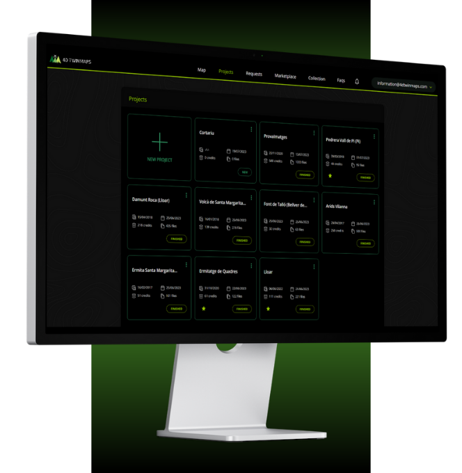
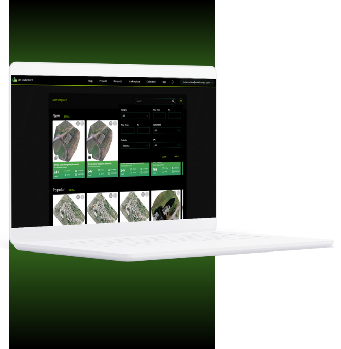
Explore our Map and Marketplace sections to discover and access a wide range of published assets created by our community.

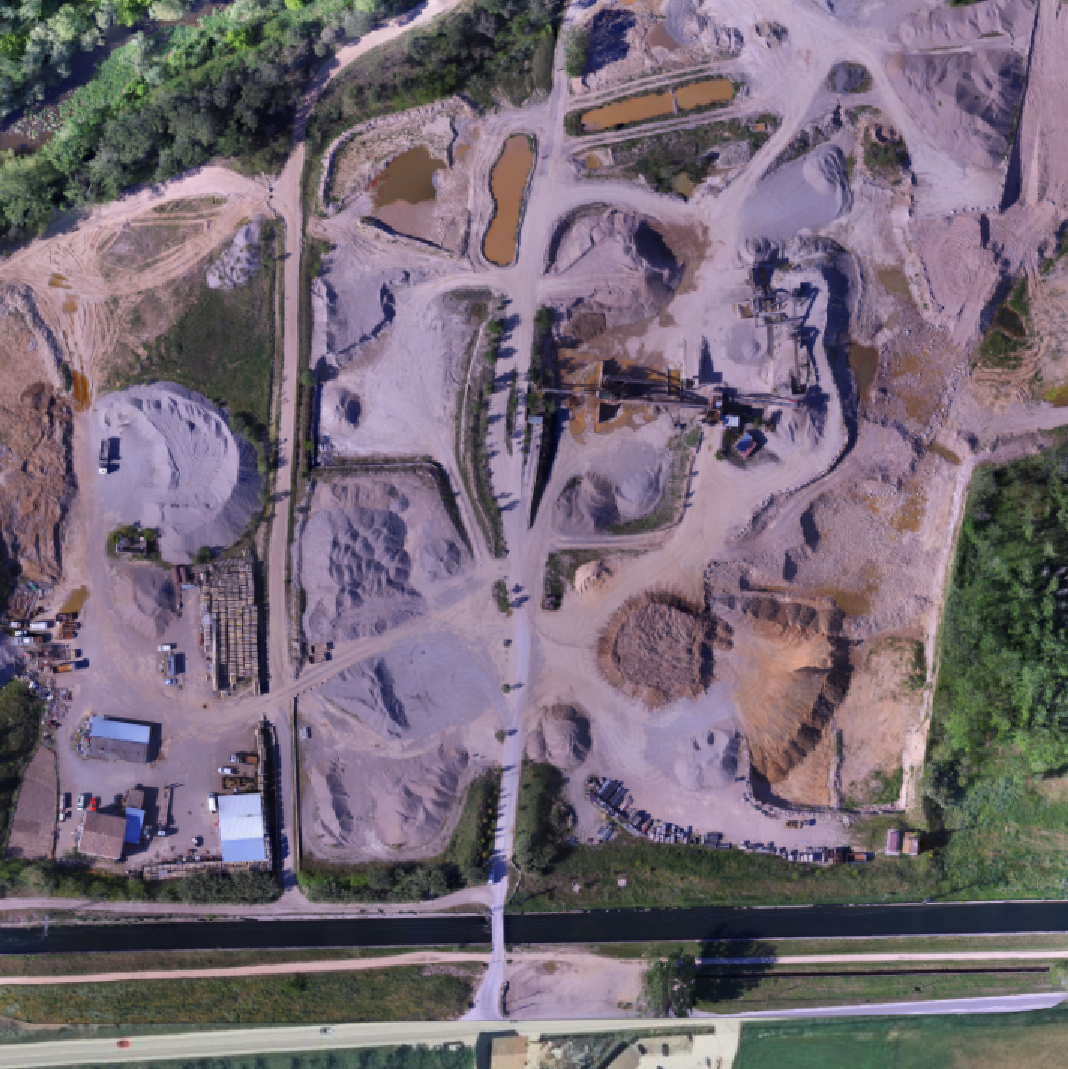
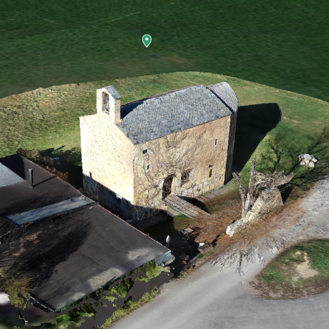
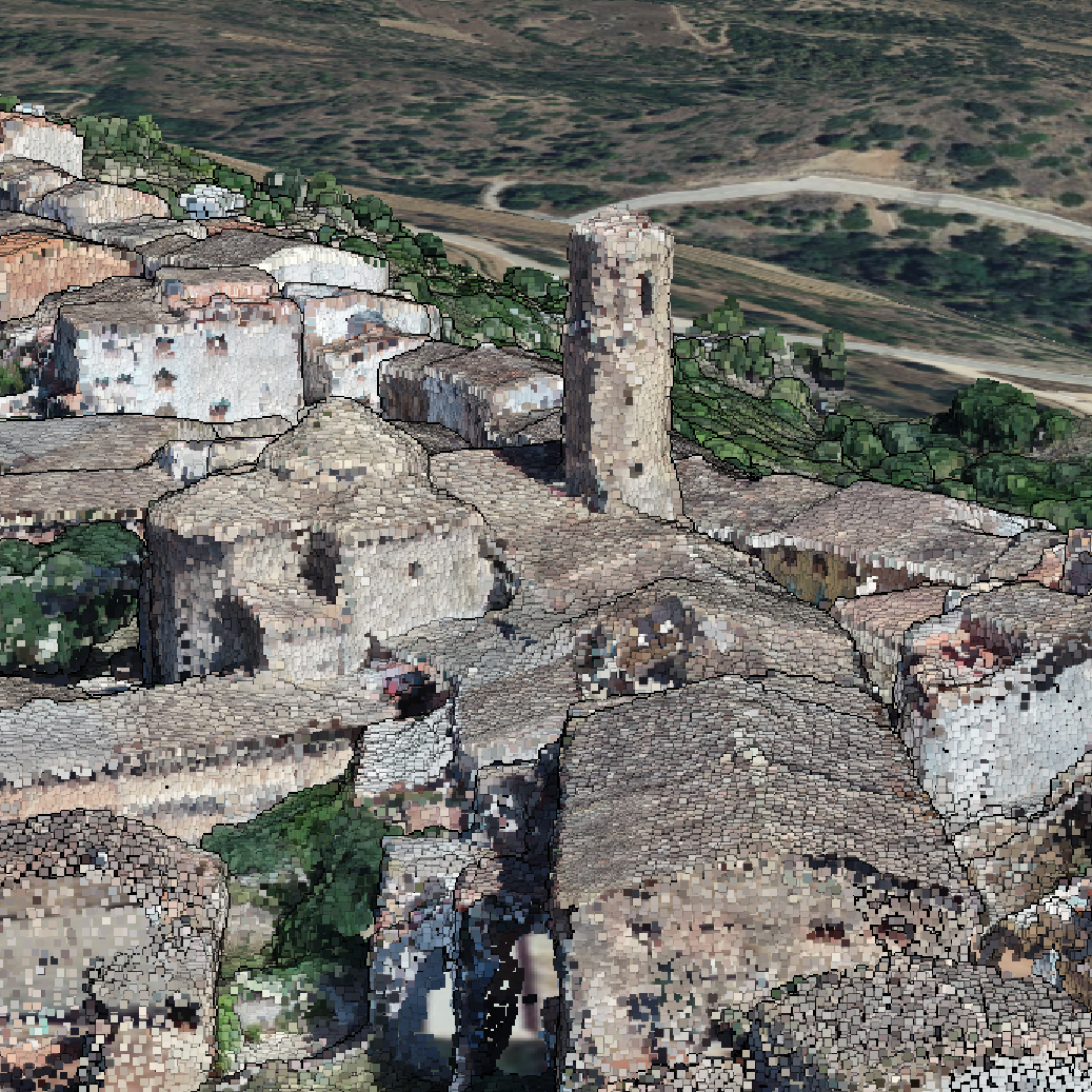
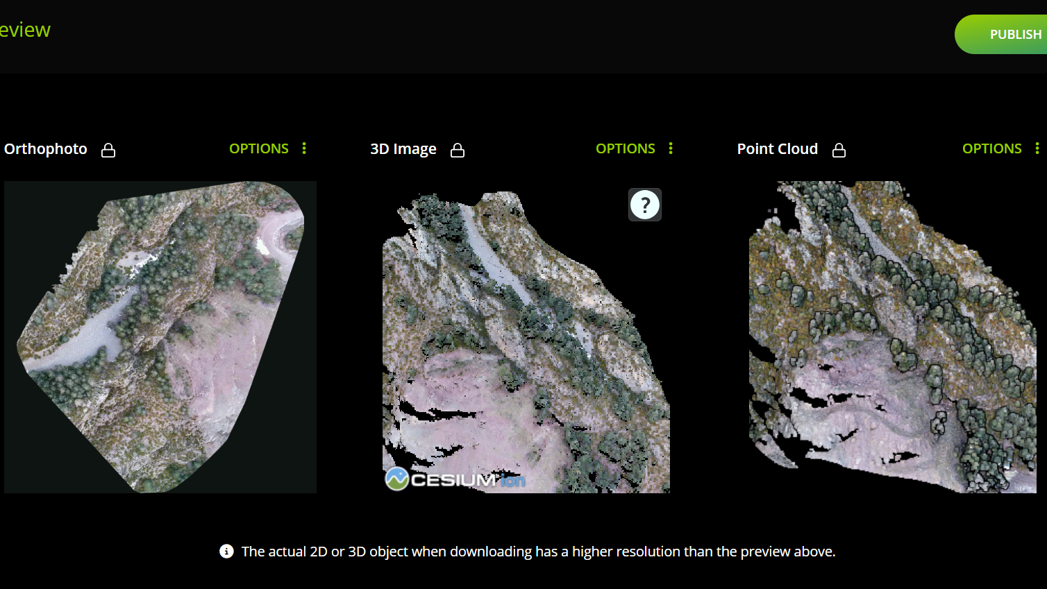
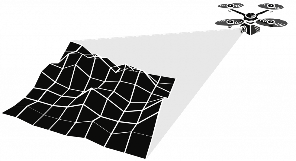
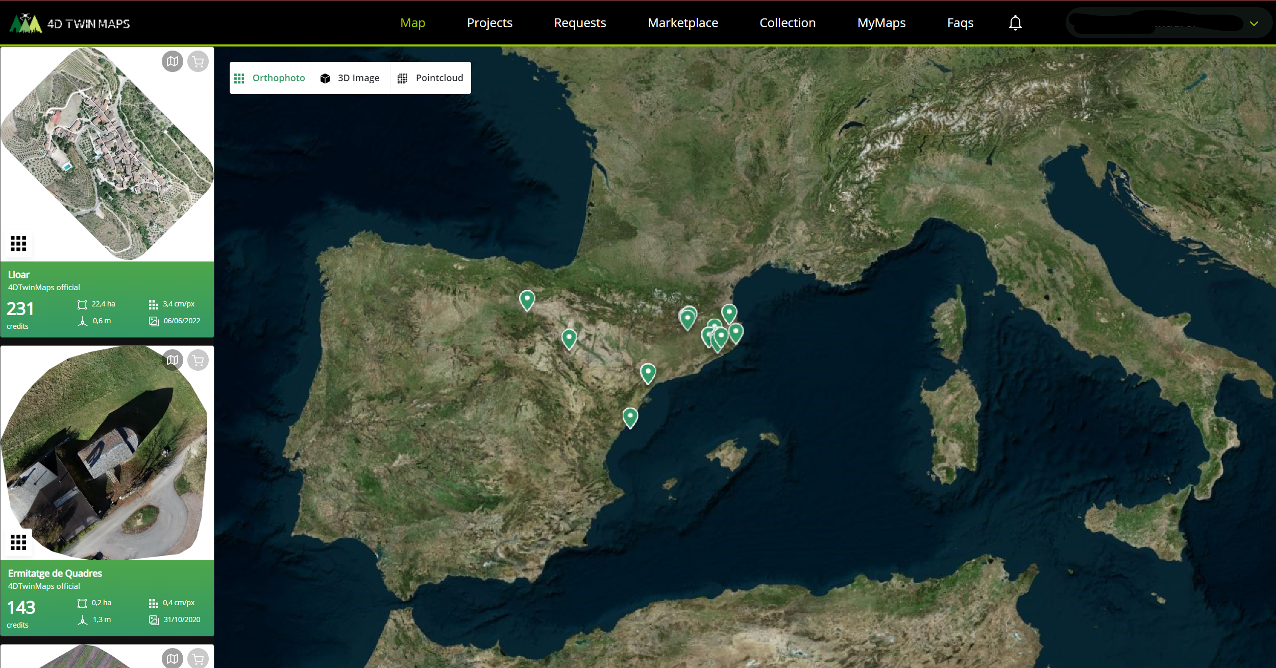
Accepted results are published in both the Map and Marketplace sections. The Map section provides a captivating 3D world map where you can view all the published orthophotos, 3D models, and point clouds. Zoom in to your desired location and click on assets of interest for more details.

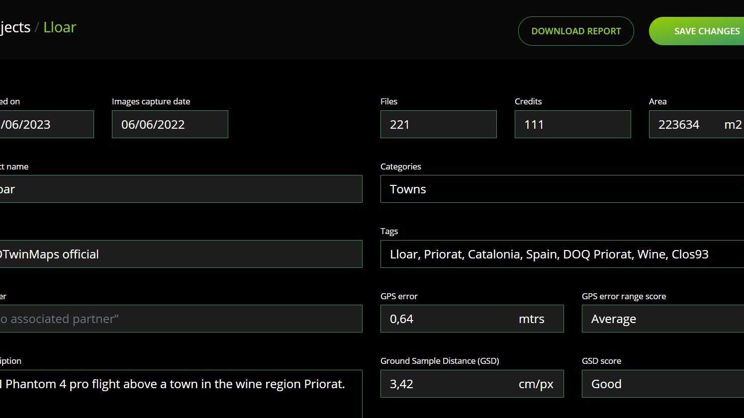
In the Map section, you can find the assets visible in your current view on the left side. To access asset information, look for the cart logo in the top-right corner of the asset card. Clicking on it will take you to the asset information page, where you can explore details such as the name, description, technical information, tags, category, and price.

Stunning Projects results

Create New Project

Get started: Use free credits or select a package from your profile.

Create a project in the 'Projects' section by clicking 'New,' then upload your images. Click 'Process' after uploading.

For optimal results, follow our image guidelines. Have GCPs? Reach out for help. Processing usually takes under 4 hours.

2D Orthophotos

Transforming drone images into high-resolution georeferenced orthophotos for mapping purposes. Share the results privately or publish them for all to see! Obtain valuable information including GPS error, Ground Sample Distance resolution, and covered area.

3D Georeferenced Model

Completing the photogrammetry process, we offer distinctive 3D models and a unique 3D globe geolocation feature for effortless sharing. Additionally, download the original 3D results for private use, or monetize your project by publishing it on our marketplace at your desired price.

3D Point Cloud

For our seasoned 3D enthusiasts and professionals, we provide dense point cloud results along with an online measurement tool for rapid annotations. Download the original results, share the 3D globe visualization, or publish it for viewing, downloading, or monetization!

Results options

Project details and assets

Check the report with technical information. Modify project details and set tags for easy searchability. View and share geodata results on a 3D globe and utilize point cloud tools for analysis. Download the original results in high quality.

New! Email us to request access to your 3D model's 3Dtile link to use in your favorite software such as QGIS, UNREAL, etc.

Want unlimited access?
Publish your project!

All published projects will be available forever. Publish your assets in our public map and marketplace.
Set a price for purchasing and downloading, make them free for download, or available only for viewing.

Approval and pricing are per result and may take up to 48 hours.

Don't want to publish? Make it Premium

Unlock extended result availability and preserve your assets indefinitely with our premium feature for just $2 per month. Safeguard your creations beyond the standard 60-day limit, enabling private sharing and downloading directly within the app. Perfect for those who prefer to keep their assets unpublished.

Point Cloud Tools

Use point cloud tools to make volume, distance, and surface measurements. Additionally, there's the possibility to create height profiles and export all this information to formats like DXF for analysis in other software.

Marketplace

The Marketplace section offers a curated collection of assets categorized under different filters. Utilize the search function to find assets based on specific criteria. Clicking on an asset will provide you with a detailed view of its information.

To acquire an asset, simply click the «Purchase» button. This allows you to spend credits and download the asset for your use. All purchased items will be stored in the Collection section.

Collection

The Collection section serves as a convenient storage area for your acquired assets. You can revisit this section to download or review purchased assets whenever you need them.

This assets also can be used on MyMaps section!

MyMaps

The MyMaps section offers the possibility to create specific, shareable maps with only the assets you select from your published projects and assets in your collection. You can edit the map to add more assets if you continue purchasing or processing more.

With the sharing link, the asset type and location view are saved, allowing you to share the exact location and type of asset you prefer.

Additionally, you can embed this link using an iframe to directly share it on a website

Request Projects to Professionals

To initiate a project request, go to the request section and click «Add». Select the country and desired company or open the request to all companies in that country. Provide a detailed description of the work, including area and site characteristics. Once all details are provided, send the request.

Responses from partners will be received through the request petition’s chat view. Engage in conversations, exchange documents or images to clarify job requirements, and establish business arrangements.

Accept a request by agreeing to the partner’s final price. Once accepted, other price offers cannot be considered, and a new project will be initiated in your project section.

After accepting a project, the partner will handle the upload and processing. However, the client retains ownership of the results and the authority to make publish requests.

Are you a geodata photogrammetry professional in your country or would you like to be?

BECOME A PARTNER TODAY


Credits for in-app use

One Time or Monthly Credit Packs

How to get free in-app credits?

Receive 200 free credits 48h after signing up

Token investment

4DMAPS token is an investment in the crypto space for our project

4D Twin Maps wants to start with its own token, then bring assets as NFT on a Blockchain

 4DMAPS community will participate in decision making on our private telegram group

– 4DMAPS Token will be used to trade assets NFTs over the Blockchain

– A portion of 4D Twin Maps services income will be used to buyback our own token

token information

4DMAPS token:

Token Name: 4D Twin Map
Token Symbol: 4DMAPS

Total Supply: 150,000,000 4DMAPS tokens

Only on BSC Chain:

0xd99903242745E8E3ecf1E2a7D4f6052282f891ee

Launch Price: $0.0005

Actual Liquidity Tokens Locked Forever (12,5%)

Dev. and Marketing Tokens Locked Until NOV 2024 (15%)

How to get free tokens?

Receive half the dollar value spent for in-app credits as 4DMAP tokens
Receive 1k 4dmaps every time you publish a project

Are You a Big Investor and Want to Buy a Big Quantity?